Nakusp Cemeteries
The following is a transcription of the Nakusp Cemeteries located in Nakusp, British Columbia, Canada, which includes the following...
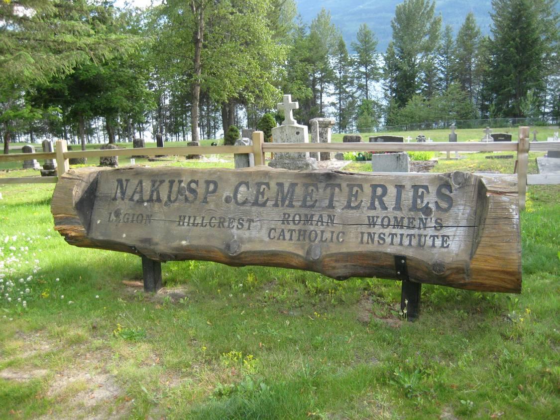
- Legion Cemetery
- Hillcrest Cemetery
- Nakusp Municipal Cemetery
- Nakusp Veteran's Cemetery
- Roman Catholic Cemetery
- Women's Institute Cemetery
Location
- Latitude: 50o 14' 29.47" N.
- Longitude: 117o 48' 44.92" W.
Historical Background
The Nakusp Cemeteries dates back to 1897 when James McNeil, owner of the Grand Hotel, purchased a waterfront lot on the west of Nakusp for a burial location for his 20 year old wife, Sadie McNeil who died in childbirth. Their daughter, also named Sadie passed away a month later. This became the place of rest for the Catholic residents of Nakusp and area.
In 1911, through the efforts of the Women's Institute additional land was purchased east of the Catholic Cemetery. This became known as the Hillcrest Cemetery. In 1935, Mrs. Edwards donated additional land for the Hillcrest Cemetery to be used for burials.
Bert Herridge in 1936 donated more adjacent land for use for the Legion addition.
By 1954 the three title holders to the cemetery lands formed a board to do joint maintenance. In 1961, Nakusp was incorporated and the Women's Institute section legally became a part of the village's mandate. A further extension came in 1971 and now the Village of Nakusp manages the site as one with the Regional District of Central Kootenay.
There are numerous unmarked graves in the Nakusp cemetery. The village was unincorporated until the mid sixties but a sketchy plot plan of the cemetery was kept. The name of the person buried was written onto this plan, sometimes a full name, sometimes only a last name or with the prefix "baby" or "Mrs".
Layout
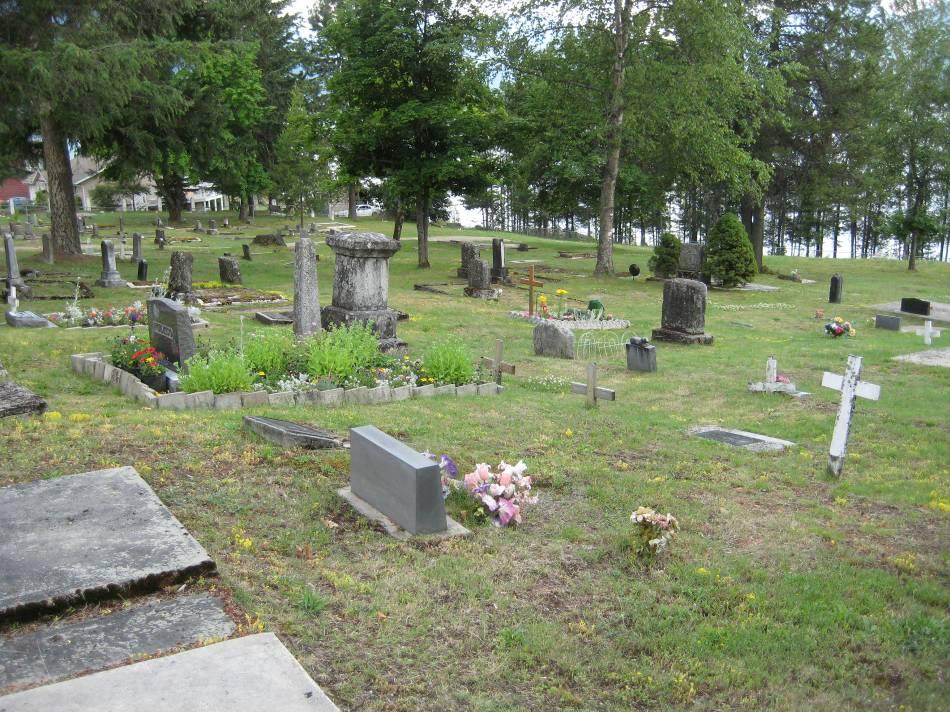
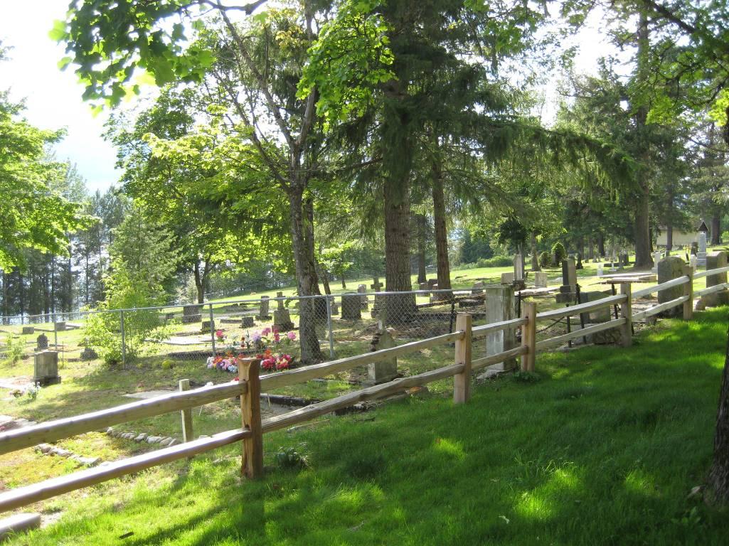
The cemeteries are pleasantly situated near the village center, overlooking the Arrow Lakes with the peaks of the Monashee Mountains in the distance. It is well maintained. The area is protected by a chain link on three sides and a wooden rail fence on the fourth.
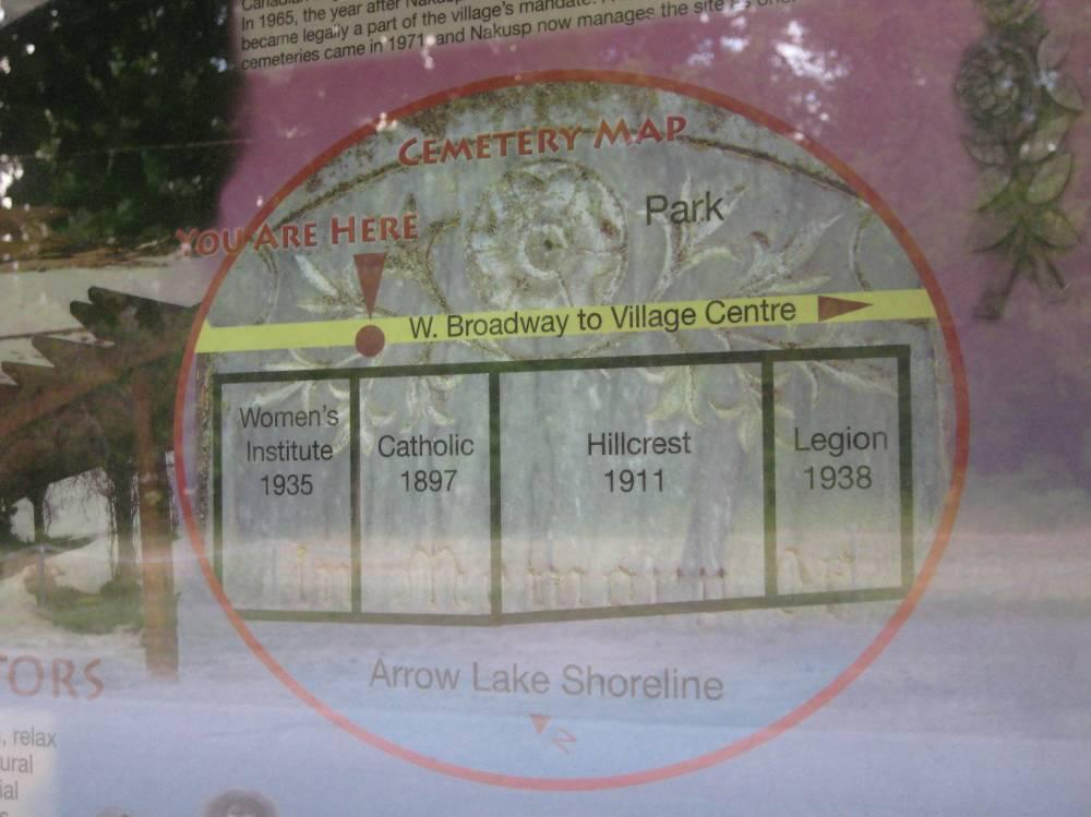
The Cemeteries consist of seven sections , Catholic (1897), Hillcrest (1911), Women’s Institute (1935), Legion (1938), New Catholic Expansion, Nakusp Nondenominational area, and the New Legion Expansion. Consequently it is registered with a number of different names including, Hillcrest Cemetery, Nakusp Municipal Cemetery, Nakusp Veteran’s Cemetery and Roman Catholic Cemetery.
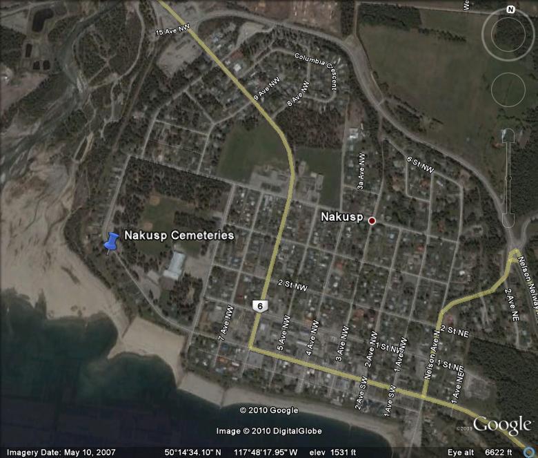
Driving Directions
From the west (Hwy 6)
Proceed through the village centre on Hwy 6 / Broadway Street W.
Continue straight on Broadway St. (do not turn at 6th Avenue).
Proceed for 0.5 km and the cemeteries are located on your left.
From the east (Hwy 23)
Proceed towards the village centre on Hwy 23, this becomes 6th Avenue NW as you near the village.
At Broadway Street, turn right.
Proceed for 0.5 km and the cemeteries are located on your left.
Interments
The interments for the Nakusp Cemetery can be viewed as a pdf file here » interments.pdf
Additional sources of information:
- Arrow Lakes Historical Society
- BC Vital Events Index
- Village of Nakusp
Last updated March 2010